Current updates on my project solely revolve around the research and construction of how I want to organize and present the project. While I’m still searching for a digital program to use, I am in the final phases of picking one out. At this point, my project will revolve around interactive storytelling or interactive mapping. The first thing that is officially done is the organization of topics for how I want to tell the history of the world through historical concepts. As of now, I have only been mainly focusing on the research part, as right now there is a lot of research data I have to sift through.
Most of my research revolves around all the secondary sources that I have gathered, as well as the small variety of primary sources I have been able to acquire so far. This research will be utilized on each and every topic to talk about the history of the world and its cross-cultural and multicultural effects across the globe. For example, one of my topic points is talking about Islam as a concept. The research of Islam I’ve acquired talks about the concept of Islam across countries in the Middle East, as well as the multicultural aspects of it in places in regions like North Africa and Southeast Asia. Some of my primary sources for this conceptual topic include travel logs of merchants who traded throughout in the Middle East, Mediterranean Sea, and Indian Ocean.
While I don’t have any immediate questions, I do seem to have a lot of challenges when constructing the project. The first is obviously what digital program I use. While I want to try new digital programs, I feel that going back to a digital program like ArcGIS StoryMaps or Scalar 2 is the best viable option. Another issue I have is finding the necessary primary sources I need for all my conceptual topics. While some have been relatively easy to find, others have not been fortunate for me to find or translated into English.
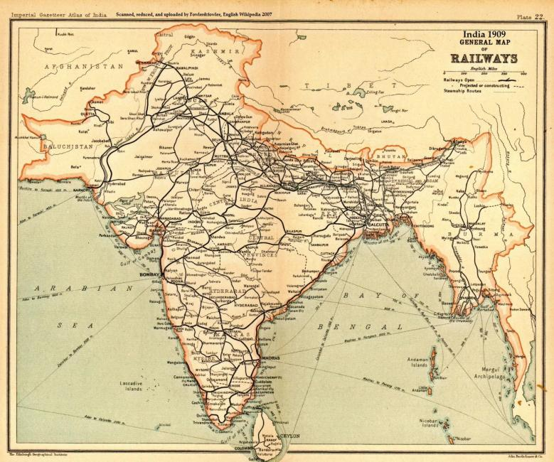
Lastly, I want to talk about the image provided above that I plan to use for my final project. This picture displays a map of railroads across the British-occupied lands of South Asia (consisting of India, Pakistan, Bangladesh, and Myanmar). I chose this picture due to its importance on discussing the impact of railroads historically, as well as its cross-cultural aspects of the world. I want to use pictures like this to show how historical concepts like railroads impacted not just countries like England, but how it was exported to other parts of the globe, whether these concepts occur separate or alongside other cultures historically.
With all this in mind, I conclude by talking about the next steps for my project. After I have all the necessary material, I will begin making a prototype using a different digital program (such as PowerPoint) to help conceptualize further how I want to construct the project. From there, I should have a digital program picked out and begin to build the project in its entirety. The project will then progress into two parts: that being filling in the data and then the media. After that, all the finishing touches will be added to make the project ready to be presented to the public.